


1 / 7
0
Views
0
Downloads


0 Likes
Latitude and Longitude Map Activity
0 Views
0 Downloads
Paste this activity's link or code into your existing LMS (Google Classroom, Canvas, Teams, Schoology, Moodle, etc.).
Students can open and work on the activity right away, with no student login required.
You'll still be able to track student progress and results from your teacher account.
Information
Description
What It Is:
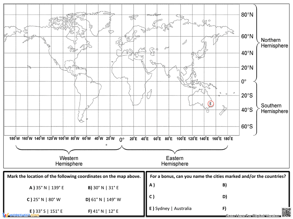
This is an educational worksheet about latitude and longitude. It includes definitions of latitude and longitude, explaining that lines of latitude run east to west and lines of longitude run north to south. The worksheet provides examples of coordinates for New York City and Sydney, Australia, showing degrees, minutes, and seconds. It also uses the analogy of a ladder to help remember the direction of latitude and longitude lines.
Grade Level Suitability:
This worksheet is suitable for upper elementary and middle school students (grades 4-7). The concepts of latitude and longitude can be introduced at this age, and the worksheet provides clear definitions and visual aids. The coordinate examples require some understanding of numerical systems, making it appropriate for students with basic math skills.
Why Use It:
This worksheet helps students understand the fundamental concepts of latitude and longitude and their importance in geography. It provides real-world examples of coordinates and uses visual aids to reinforce learning. It also offers a mnemonic device (the ladder analogy) to help students remember the direction of latitude and longitude lines.
How to Use It:
Students can read the definitions and examples provided on the worksheet. They can then use the map provided to identify the location of New York City and Sydney based on the coordinates. Teachers can use this worksheet as part of a lesson on geography or map reading, supplementing it with additional activities and discussions.
Target Users:
The target users are students in grades 4-7 who are learning about geography, map reading, or coordinate systems. It is also beneficial for teachers looking for a visual and informative worksheet to supplement their lessons on latitude and longitude.