


1 / 2
0
Views
0
Downloads


0 Likes
Practice with Latitude Longitude Worksheets
0 Views
0 Downloads
Paste this activity's link or code into your existing LMS (Google Classroom, Canvas, Teams, Schoology, Moodle, etc.).
Students can open and work on the activity right away, with no student login required.
You'll still be able to track student progress and results from your teacher account.
Information
Description
What It Is:
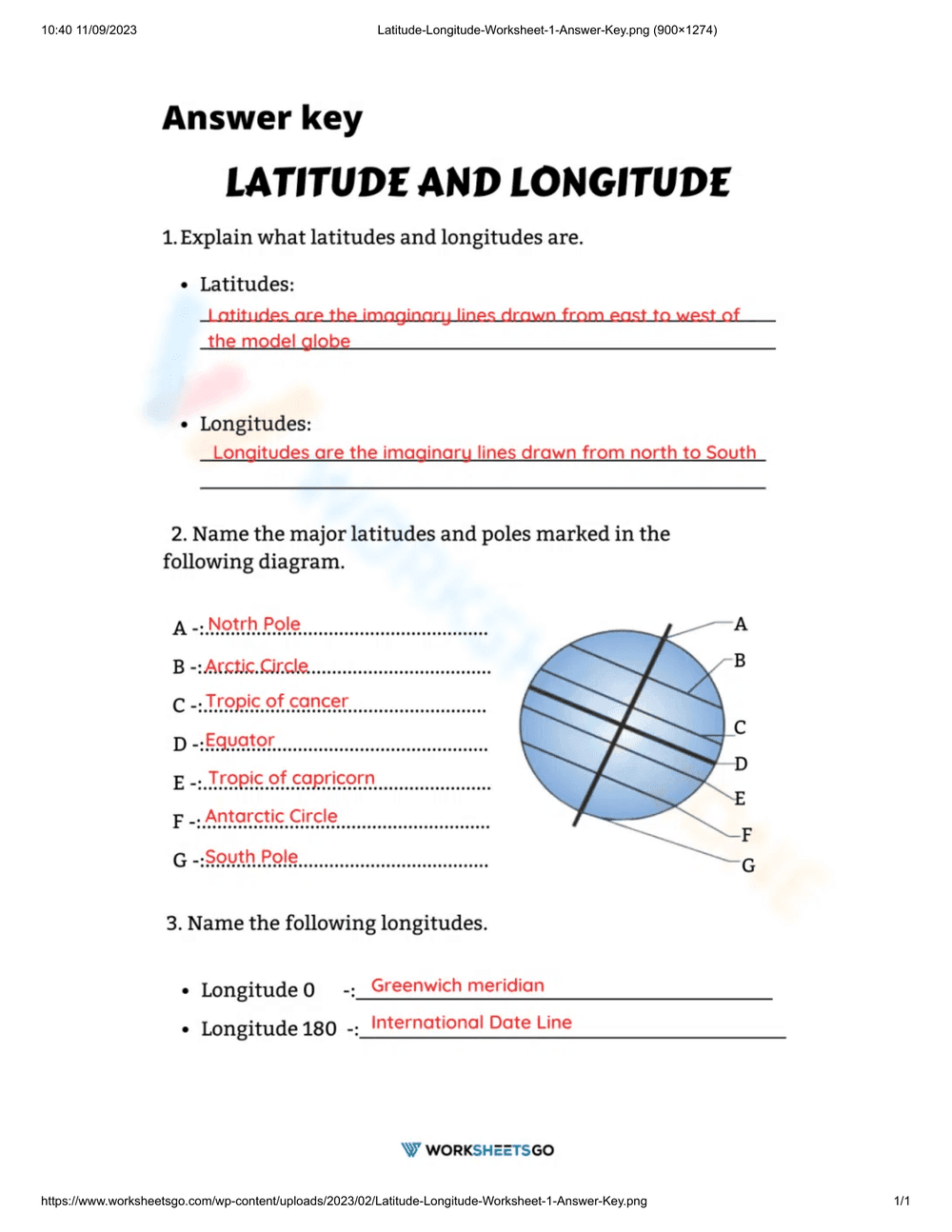
This is an educational worksheet focused on Latitude and Longitude. It contains three exercises: defining latitude and longitude, labeling major latitudes and poles on a diagram of the Earth, and naming specific longitudes (0 and 180 degrees). The diagram shows a globe with lines of latitude and longitude, labeled A through G.
Grade Level Suitability:
This worksheet is suitable for grades 5-7. The concepts of latitude and longitude are typically introduced in upper elementary or middle school geography lessons. The tasks require basic understanding and recall of geographical terms.
Why Use It:
This worksheet helps students understand and reinforce their knowledge of latitude and longitude. It improves their understanding of global geography and spatial relationships. The labeling exercise enhances visual learning and reinforces the positions of key geographical features.
How to Use It:
Students should first define latitude and longitude in their own words. Next, they should use their knowledge of geography to label the lines and poles on the diagram (A-G). Finally, they should identify the names of the 0 and 180 degree longitudes. Teachers can use this as in-class activity, homework, or as a review exercise.
Target Users:
This worksheet is designed for students learning about geography, specifically latitude and longitude. It's useful for teachers looking for supplementary materials to teach these concepts. It is also useful for homeschoolers learning about the world.