


1 / 6
0
Views
0
Downloads


0.0
0
0 Likes
Interactive Latitude and Longitude Worksheets
0 Views
0 Downloads
Paste this activity's link or code into your existing LMS (Google Classroom, Canvas, Teams, Schoology, Moodle, etc.).
Students can open and work on the activity right away, with no student login required.
You'll still be able to track student progress and results from your teacher account.
Information
Description
What It Is:
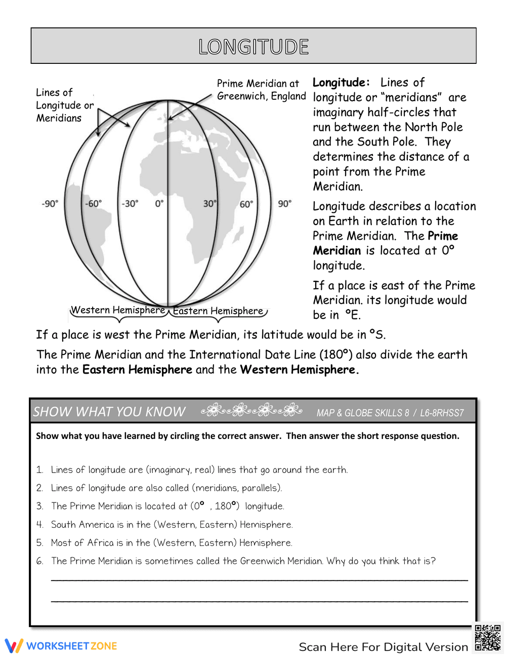
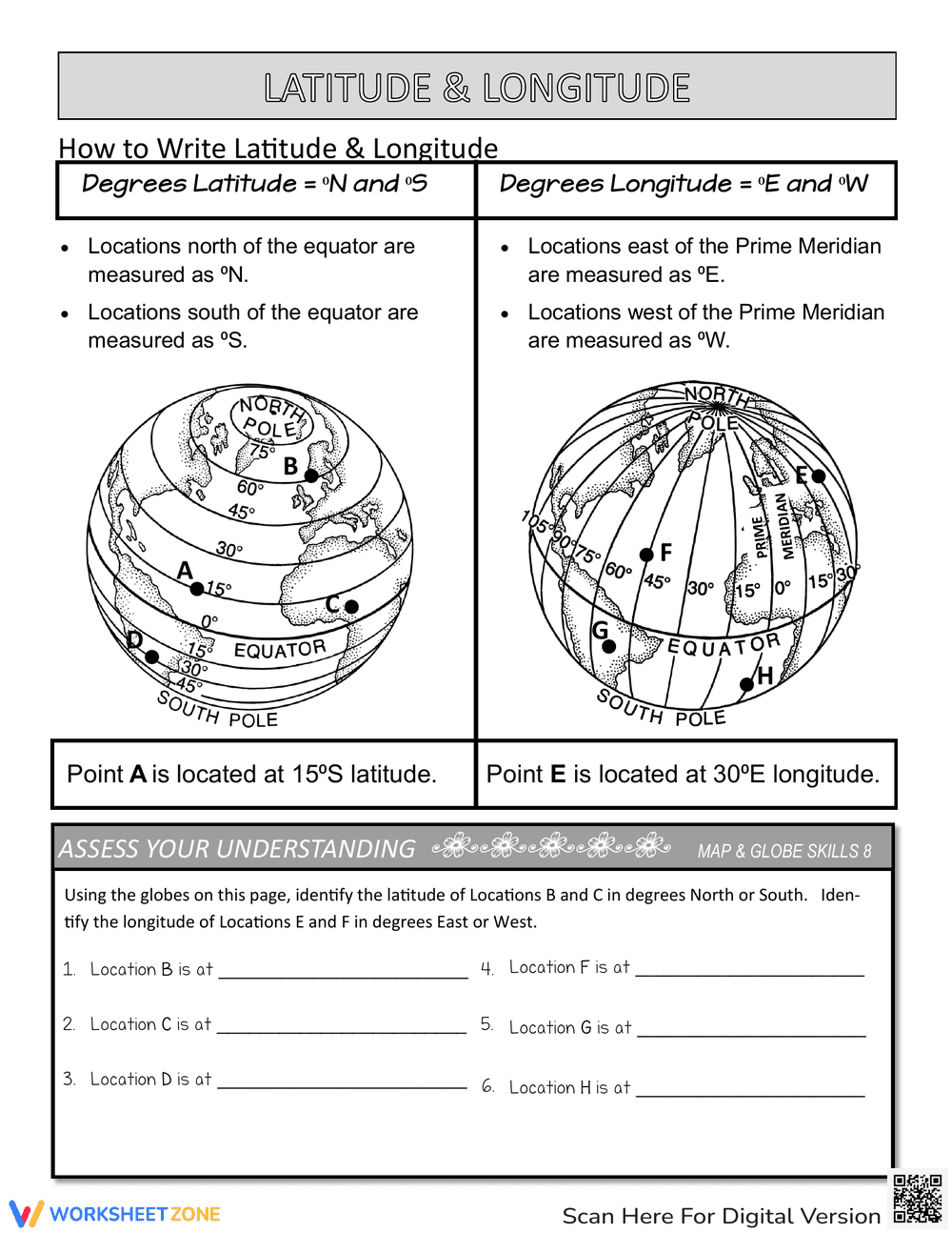
This is an educational worksheet focused on teaching latitude. It includes a diagram of the Earth showing lines of latitude or parallels, the equator, and the North and South Poles, with labels indicating their respective latitudes (90°N and 90°S). The worksheet also provides a brief definition of latitude and its relation to the equator and hemispheres. The 'Show What You Know' section contains eight multiple-choice questions where students circle the correct answer about latitude, the equator, and the location of places on Earth.
Grade Level Suitability:
This worksheet is suitable for grades 3-5. The concepts presented, such as lines of latitude, the equator, and the location of the poles, are typically introduced in elementary school geography lessons. The multiple-choice questions are simple and straightforward, making it accessible for this age group.
Why Use It:
This worksheet reinforces understanding of latitude, the equator, and their significance in locating places on Earth. It helps students visualize the concept of latitude through a clear diagram. The multiple-choice questions assess comprehension and encourage critical thinking about geographical locations.
How to Use It:
Begin by reviewing the definition and diagram of latitude. Explain the relationship between latitude, the equator, and the North and South Poles. Students can then complete the 'Show What You Know' section by circling the correct answers to the questions. Review the answers together to reinforce learning.
Target Users:
The target users are elementary school students (grades 3-5) learning about geography, specifically latitude and the Earth's hemispheres. It is also suitable for teachers looking for a supplemental activity to reinforce map and globe skills.