


1 / 3
0
Views
0
Plays

0 Likes
Discover the Empire of Mali: Quiz on Rulers, Trade, and Society
0 Views
0 Plays
Paste this activity's link or code into your existing LMS (Google Classroom, Canvas, Teams, Schoology, Moodle, etc.).
Students can open and work on the activity right away, with no student login required.
You'll still be able to track student progress and results from your teacher account.
Information
Description
What It Is:
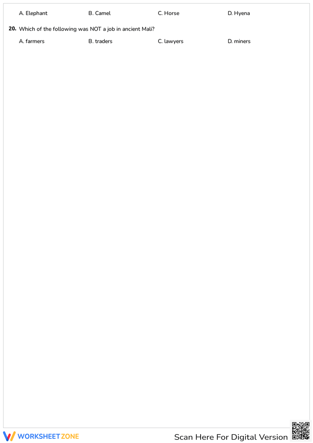
This is a world map worksheet showing the continents. The continents are labeled with their names: North America, South America, Europe, Africa, Asia, Australia, and Antarctica. The map is a simple outline, intended for students to learn the location of each continent.
Grade Level Suitability:
This worksheet is suitable for elementary school grades, specifically 1st through 4th grade. It's appropriate for this age group because it introduces basic geography concepts and helps students visually identify and learn the names of the seven continents.
Why Use It:
This worksheet helps students develop their geographical knowledge by learning the names and locations of the continents. It improves map reading skills and provides a foundation for understanding world geography. It's a good starting point for discussions about different countries, cultures, and environments.
How to Use It:
Students can use this worksheet to practice identifying and labeling the continents. They can color the continents to differentiate them. Teachers can use it as a starting point for a geography lesson or as a quiz to test students' knowledge.
Target Users:
This worksheet is designed for elementary school students, particularly those in the early grades learning about world geography. It is also useful for homeschoolers and anyone wanting to learn the basics of continent identification.