


1 / 7
0
Views
0
Plays


0 Likes
Atmospheric Circulation Patterns Quiz
0 Views
0 Plays
Paste this activity's link or code into your existing LMS (Google Classroom, Canvas, Teams, Schoology, Moodle, etc.).
Students can open and work on the activity right away, with no student login required.
You'll still be able to track student progress and results from your teacher account.
Information
Description
What It Is:
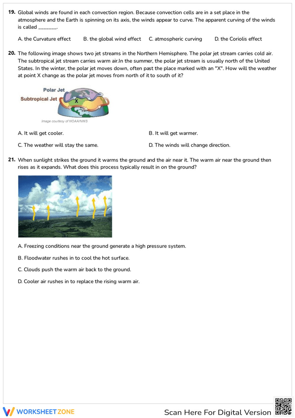
This is an educational diagram showing the polar and subtropical jet streams around the Earth. The diagram includes a globe with continents, labeled jet streams (polar and subtropical), arrows indicating the direction of the wind flow, and a compass rose showing North, South, East, and West. The letter 'X' is marked on the globe, possibly indicating a specific location or area of interest.
Grade Level Suitability:
This diagram is suitable for middle school (grades 6-8) and high school (grades 9-12) students. The concepts of jet streams and global wind patterns are typically introduced in these grades as part of earth science or geography curricula. The diagram provides a visual representation of these complex systems.
Why Use It:
This diagram helps students visualize and understand the concept of jet streams and their location relative to the Earth's geography. It clarifies the difference between the polar and subtropical jet streams and their general direction of flow. It supports learning about weather patterns and global climate.
How to Use It:
Use this diagram as a visual aid during a lesson on jet streams. Ask students to identify the polar and subtropical jet streams. Discuss the direction of the wind flow. Use the compass rose to determine the direction of the jet streams at different locations. You can also use it to discuss the impact of jet streams on weather patterns. The 'X' can be used as a discussion point to explore local weather patterns influenced by the jet streams.
Target Users:
The target users are middle and high school students studying earth science, geography, or meteorology. Teachers can use it as a teaching tool, and students can use it as a reference for understanding jet streams. Anyone interested in learning about weather patterns and global climate can benefit from this diagram.