


1 / 21
0
Views
0
Downloads


0 Likes
Comprehensive Topographic Maps Worksheet
0 Views
0 Downloads
Paste this activity's link or code into your existing LMS (Google Classroom, Canvas, Teams, Schoology, Moodle, etc.).
Students can open and work on the activity right away, with no student login required.
You'll still be able to track student progress and results from your teacher account.
Information
Description
What It Is:
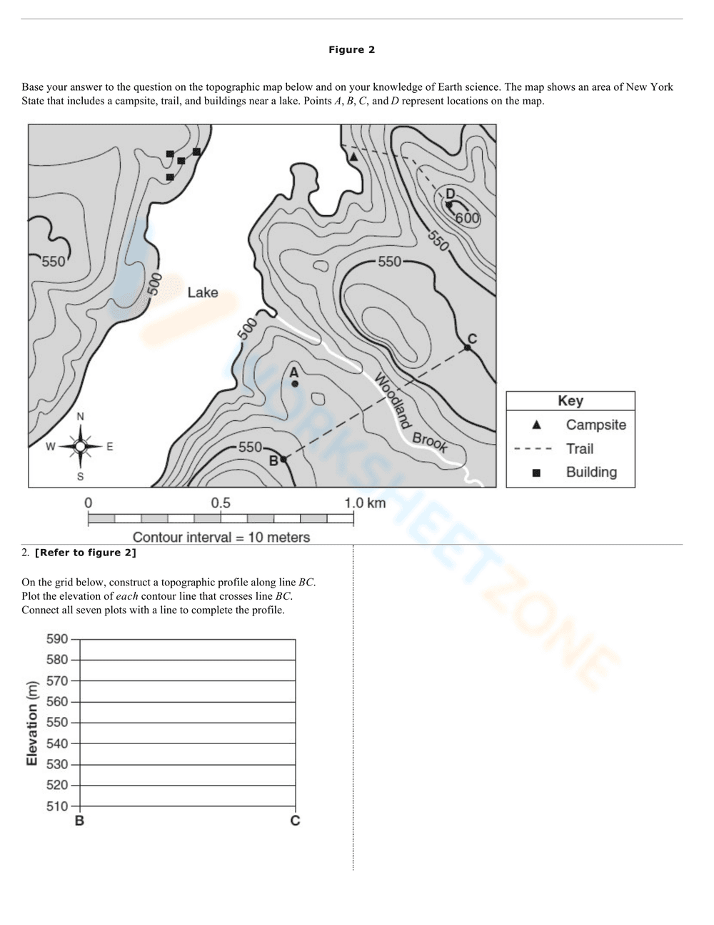
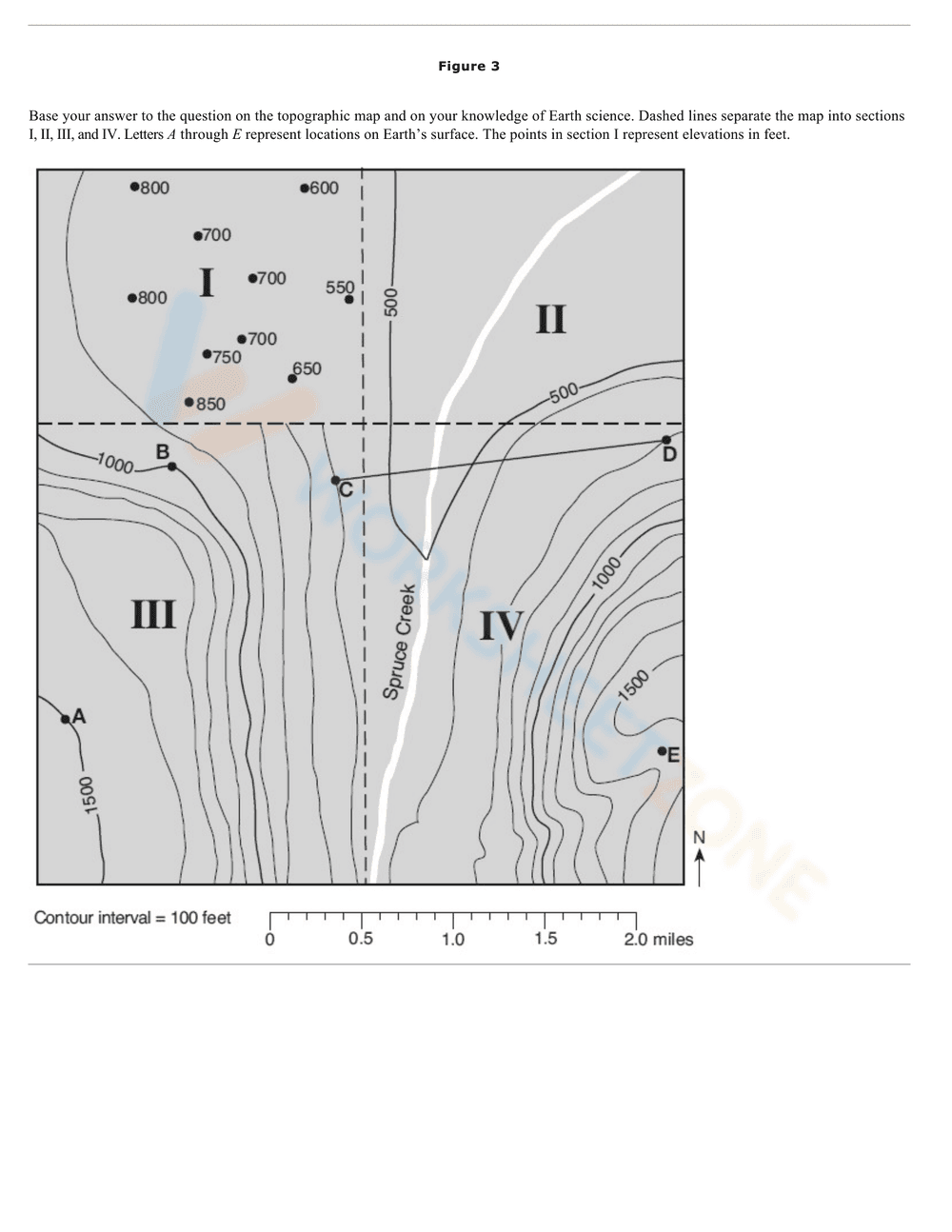
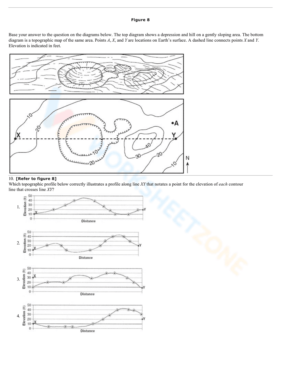
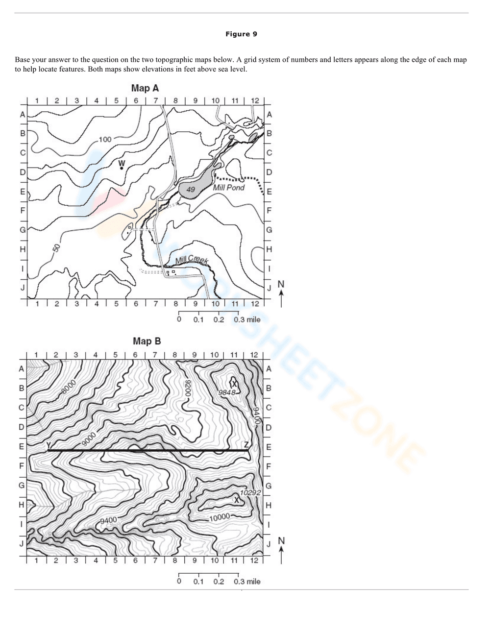
This is a topographic map profile practice worksheet. It features a topographic map with contour lines, elevation markers, a pond labeled 'Calden Pond', a creek, and points labeled A, B, C, D, E, F, and G. Two lines, BC and XY, are drawn across the map. A scale indicates a contour interval of 20 feet. A key shows the symbol for a depression contour line. The worksheet asks students to base their answers on the topographic map and their knowledge of Earth Science.
Grade Level Suitability:
This worksheet is suitable for grades 6-9, particularly in Earth Science or Geography classes. The concepts of topographic maps, contour lines, and elevation are typically introduced at this level. The complexity of the map and the analysis required make it appropriate for middle school students.
Why Use It:
This worksheet helps students develop skills in reading and interpreting topographic maps. It reinforces understanding of contour lines, elevation, and landforms. It allows students to practice analyzing spatial relationships and visualizing three-dimensional landscapes from two-dimensional maps.
How to Use It:
Students should first familiarize themselves with the key and the contour interval. They should then analyze the map to identify features like hills, valleys, and depressions. Students can use the lines BC and XY to create topographic profiles. The points A-G can be used to determine specific elevations and locations.
Target Users:
The target users are middle school students learning about topographic maps in Earth Science or Geography classes. It is also beneficial for students who need to practice spatial reasoning and map reading skills.