


1 / 2
0
Views
0
Plays

0 Likes
Geography and Society of West African Kingdoms Quiz
0 Views
0 Plays
Paste this activity's link or code into your existing LMS (Google Classroom, Canvas, Teams, Schoology, Moodle, etc.).
Students can open and work on the activity right away, with no student login required.
You'll still be able to track student progress and results from your teacher account.
Information
Description
What It Is:
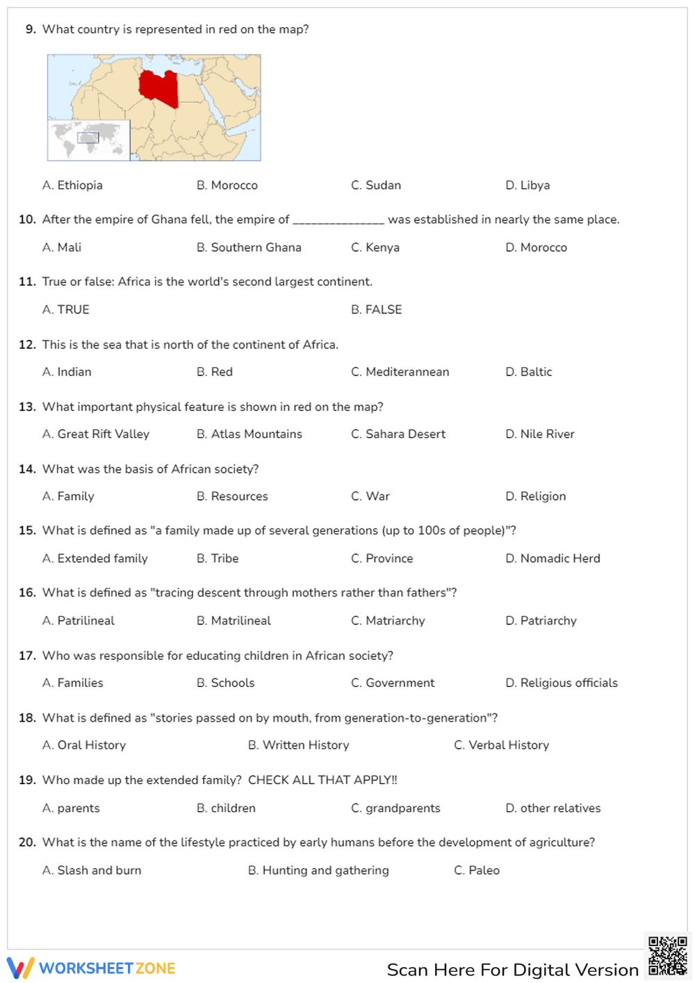
This is a map highlighting the country of Libya in red. The map shows Libya's location in North Africa and its surrounding countries. A smaller world map is included to show the general location of the highlighted region.
Grade Level Suitability:
Grades 3-7. This worksheet is suitable for elementary and middle school students learning about geography, specifically African countries. It is appropriate for introducing the location of Libya in a global context.
Why Use It:
This worksheet helps students visualize the location of Libya within Africa and the world. It can be used to teach map reading skills, identify neighboring countries, and understand the geographical context of Libya.
How to Use It:
Use this map as a visual aid during a geography lesson about Africa or Libya. Students can label the surrounding countries, identify major bodies of water, or research facts about Libya's geography. The smaller world map can be used to show the relative location of Libya compared to other continents.
Target Users:
Elementary and middle school students studying geography, world cultures, or African countries. Teachers can use this as a supplementary material for their lessons.